Yes, the Sawtooth Fire is Still There
The smoke cleared away enough Friday afternoon that we could see....more smoke.
At sunset September 28th, the column of smoke from the westward-bound Sawtooth forest fire looked like early days of the fire at the beginning of the month. The fire was handed over to a management from the Bitterroot National Forest Friday. It has burned 5,882 acres so far, and has most recently been burning in the Sawtooth Canyon to the west into the Selway-Bitterroot Wilderness.
The air in the Bitterroot Valley has been less dense at times, with the air particulate count at the Ravalli County Courthouse in Hamilton at the "Unhealthy for Sensitive Groups" level for most of Friday. The cumulative counts were "Unhealthy" - both 8-hour and 24-hour.
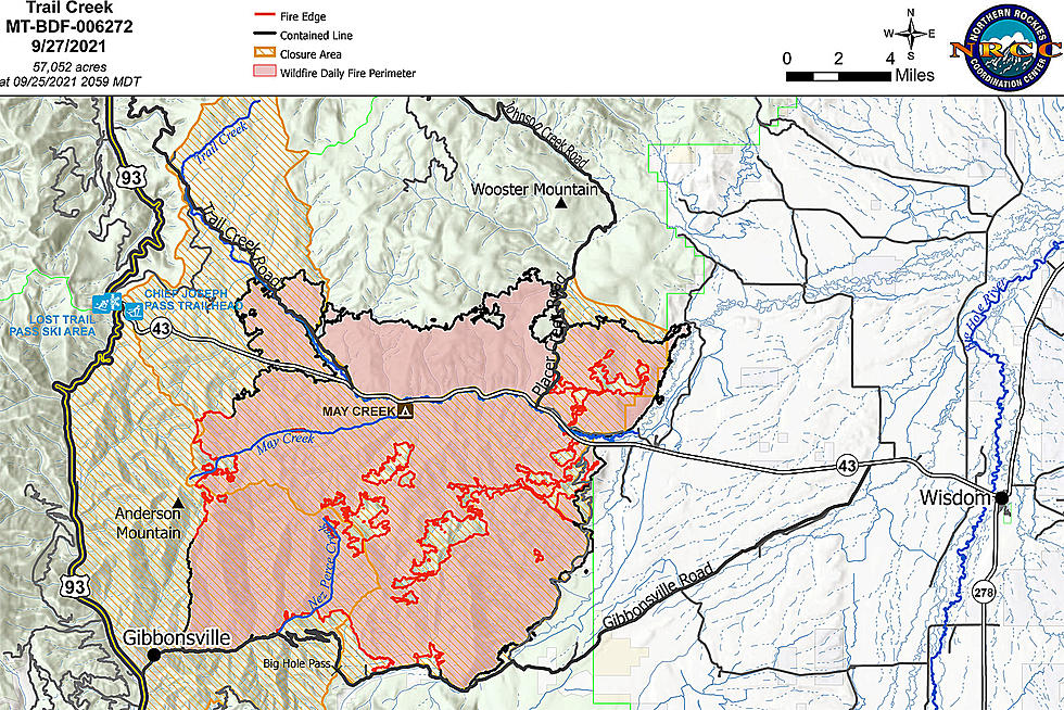
The large forest fires near the Bitterroot Valley continue to slowly grow. The Powell Complex southwest of Lolo in the Selway-Bitterroot Wilderness is now listed at 57,000 acres. Crews have been sent in to protect some of the backcountry facilities, including the Fish Lake Airstrip, the Beaver Ridge lookout area and the Elk Summit recreation area. The Highway 12 corridor on the Idaho side of Lolo Pass continues to suffer through thick smoke, with caution urged for drivers.
As of Friday:
More From 94.9 KYSS FM