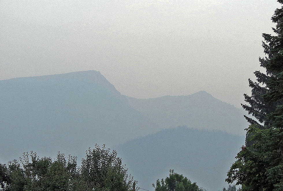
Idaho Fires Deliver The Smoke to Bitterroot
Wednesday night, the 3,500-acre Storm Creek Fire sent an extra helping of smoke into the Victor area of the Bitterroot Valley. Residents thought there was a fire close by. The Ravalli County Sheriff's Office checked with forest officials and reported the smoke was from the Storm Creek Fire, the largest fire in the Powell Ranger District in the Selway-Bitterroot.
The Storm Creek Fire is about 4 miles west of the Montana-Idaho border (see map above) and Mike Martin of the Nez Perce-Clearwater National Forest said the wilderness fire has the potential for more growth. The area around the fire is closed on the east side from North Fork of Storm Creek to the Montana-Idaho border and south along the border to Trail 50.
Up to the west and north of the Storm Creek Fire is the Granite Pass Complex of four forest fires near Lolo Pass (see map above) in both Montana and Idaho. The firefighters are hoping to keep the Lolo Creek Fire from crossing US 12. Speed limits in that area are 45 miles per hour and motorists are advised to not stop along the roadway. The other fires in that complex are the BM Hill, the Shotgun and the Boulder Creek fires on both the Nez Perce-Clearwater and the Lolo National Forests. Total size is about 2,375 acres. A community meeting on the Granite Pass Complex will be held Friday, July 23, at 7 p.m. at the Lolo Elementary School.
The other main smoke producer for the Bitterroot Valley is the Dixie-Jumbo Fire south of Grangeville, Idaho. Smoke from the 29,360 acre fire is coming into the mid-valley south of Hamilton. Thursday, air quality in the Hamilton area has been hovering between "Moderate" and "Unhealthy for Sensitive Groups."
Small fires have been attacked and extinguished in the Bitterroot National Forest. However, southeast of the valley on the Beaverhead-Deerlodge National Forest, Highway 43 into the Big Hole has been closed at times because of the 24,000 acre Trail Creek Fire west of Wisdom, along with the 5,674-acre Alder Creek Fire and more recent 210-acre Christensen fire in the Wise River area. Those fires are on National Forest and BLM land. Stage 2 fire restrictions are in effect locally.
READ ON: See the States Where People Live the Longest
Gallery Credit: Hannah Lang
LOOK: Here are the 50 best beach towns in America
Gallery Credit: Keri Wiginton
LOOK: What major laws were passed the year you were born?
Gallery Credit: Katelyn Leboff
More From 94.9 KYSS FM